Introduction0.1Page
Welcome!

Welcome again to Growing Up Boulder’s (GUB) Child-Friendly City Map Course! Before you start, it is important that you know what a Child-Friendly City (CFC) and a Child-Friendly City Map (CFC map) are. It is also important to know how a map based on the principles of a child-friendly city can be a great tool for and benefit to your city.
What is a Child-Friendly City?
According to UNICEF, a child-friendly city is “a city, town or community in which the voices, needs, priorities and rights of children are an integral part of public policies, programs and decisions.” In Stage 1, you’ll be building your background on Child-Friendly City Initiatives around the world. To begin your research, we encourage you to read the Child Friendly Cities and Communities Handbook below.

Read the Child Friendly Cities and Communities Handbook (PDF)
A copy of the 2018 edition is also saved with this course, in case the link above moves.
What is a Child-Friendly City Map?A Child-Friendly City Map (CFC map) is a digital or printed map that is based on CFCI principles and created for children, by children. The map highlights areas within a city or community where children feel safe, welcome, and celebrated. Not surprisingly, points on a child-friendly city map are often children's favorite places to visit with family and friends, and are a great resource for children and families who are visiting. Ultimately, a CFC map showcases a city's assets, celebrating all of the great things happening in a place. A CFC map also shows where your city has room for improvement in regards to its ability to engage and welcome children. Thus, CFC maps also identify barriers, limitations and inequities within a community. Based on the United Nations Convention on the Rights of the Child, child-friendly cities all over the world are grounded in the idea that children, no matter how small, enjoy rights as current citizens, and as such should be involved in civic decisions that affect them. Creating a child-friendly city map alongside children validates the idea that children are experts of their own lived experience, and, moreover, that they are amazing thinkers, capable of contributing to the positive development of their cities and communities right now--and not in some distant future. |
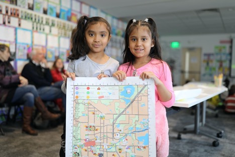
Two University Hill Elementary 2nd grade change-makers provide feedback on the first draft of the map during their Museum of Boulder “Humans of Boulder--Big and Small” Bilingual Showcase event. Photo by Jade Cody |
 Purpose of a Child-Friendly City Map
The five main purposes of a CFC map are:
- To highlight free or low-cost activities for ALL children (and their families) in the local community. This not only allows children and families to take advantage of community offerings, but it often reduces isolation so that families of young children have opportunities to meet each other in public spaces.
- To activate public spaces within the community.
- For children to have a say in shaping their community by identifying assets and barriers from their perspective, by voicing what makes something child-friendly and by creating a useful tool that can be used by all ages.
- To make a city more child-friendly, since the process of map-making itself identifies assets and barriers to child-friendly spaces and amenities.
- To inform positive, child-friendly change in a community.
What does a CFC map look like?
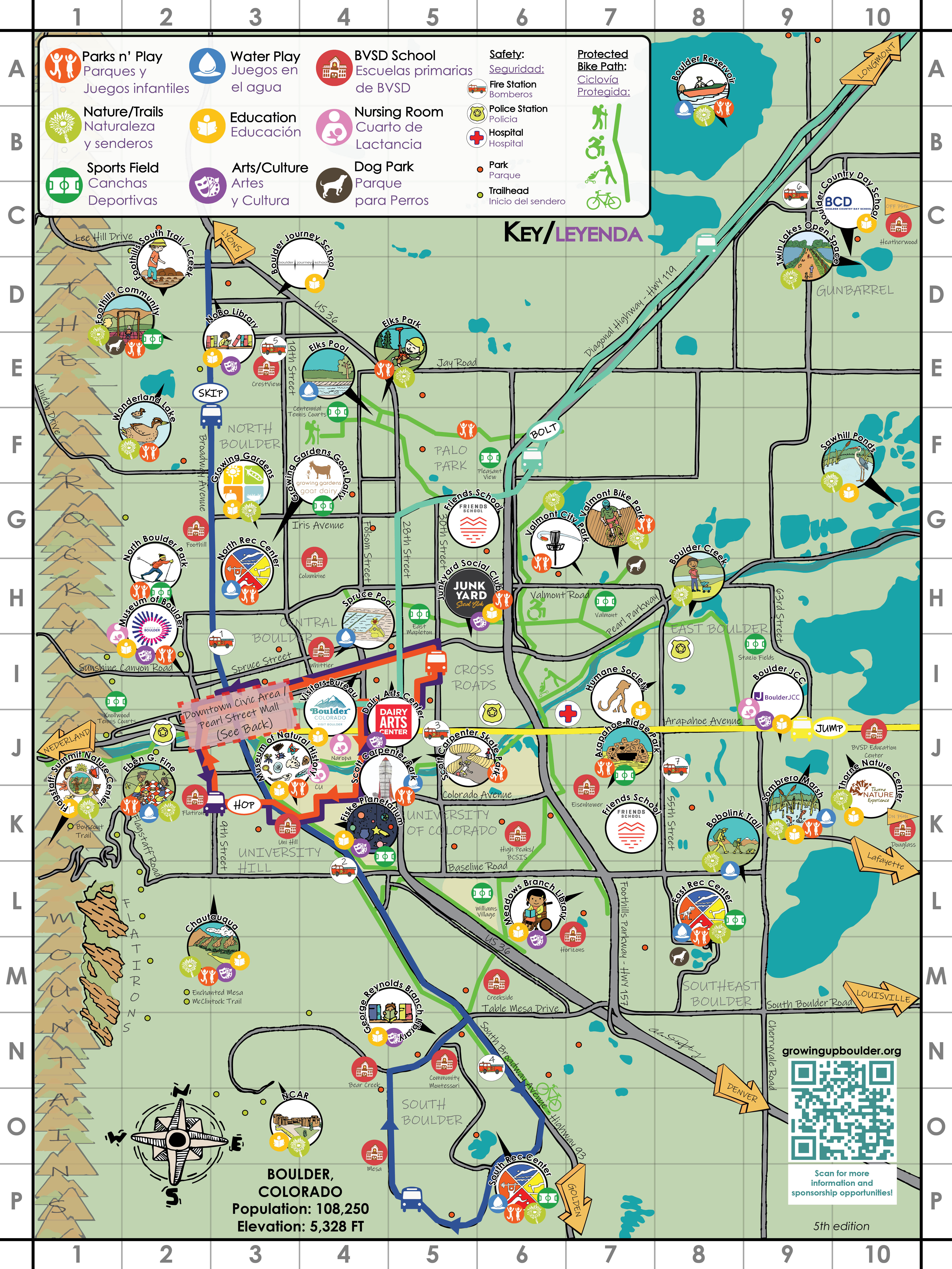
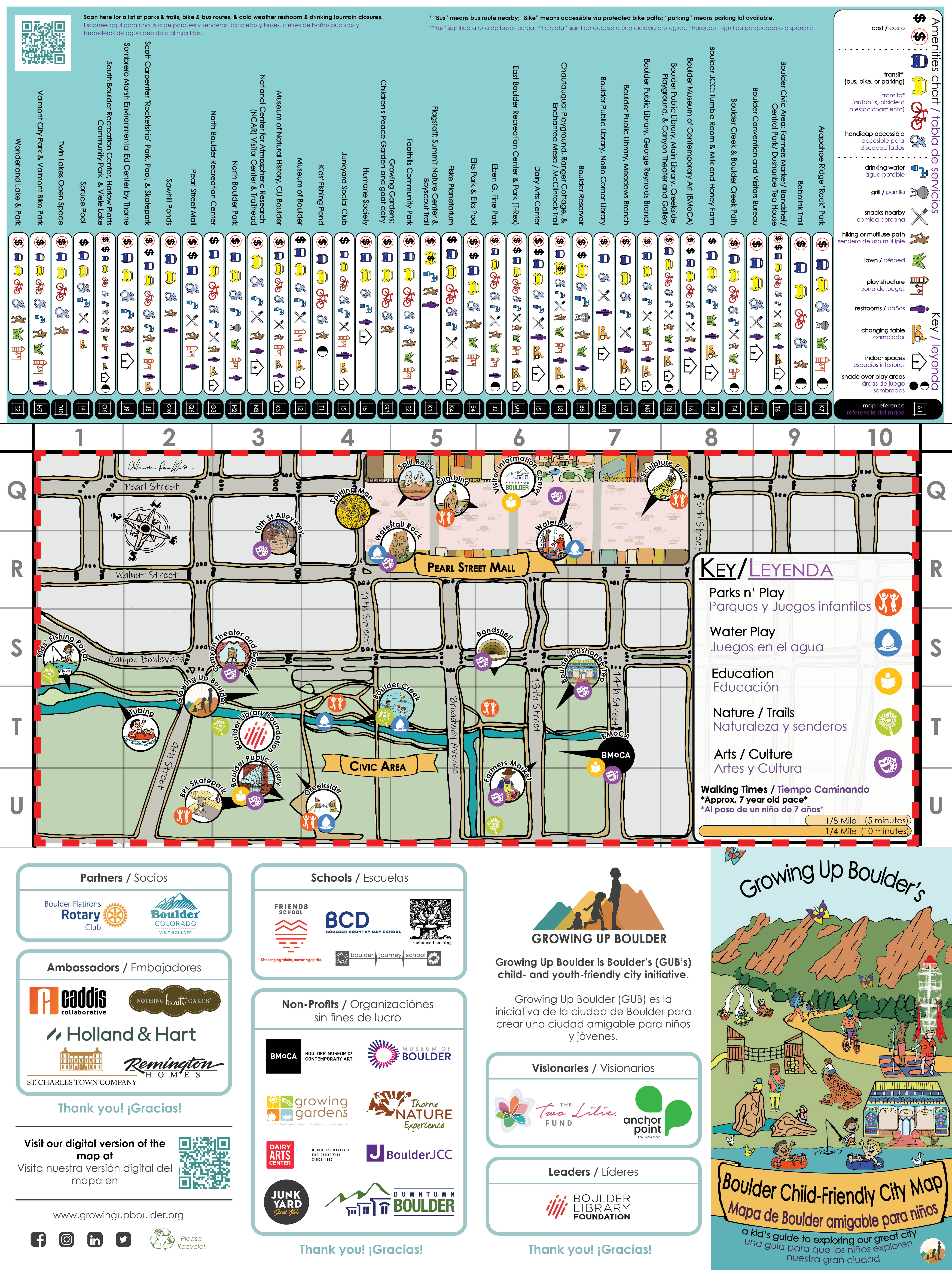
This depends on your city and the children you work with! Below, is an example of GUB’s printed CFC map (we also have child- and teen-friendly digital maps). Since its 1st publication in 2018, Boulder’s CFC map has gone through several iterations, each time with children’s input. Our maps are extremely popular–we print approximately 15,000 every year. When you create a map together with your community, it will reflect your city’s values, assets, and the unique ways that make your community child-friendly.
 |  |
Beginning Your Map-Making Journey
As you continue through this course, you will be guided in the steps to make your own child-friendly city map for your community. Click “NEXT” at the bottom of this page to continue on to learn how we’ve structured the course and some of the more important details. If you are ever lost, return to the “Modules” section (at left) to see what activities you have already completed and what your next steps are on your map-making journey.