Congratulations! You have arrived at an exciting part in this map-making journey: bringing all the data you have collected and analyzed, and working with your map designer to begin creating your map! As you might expect, there are many important considerations at this stage. In our view, the most important of which is to develop a good working relationship with your designer and to get on the same page in terms of shared values and goals. You'll want to start meeting together regularly from this point forward. First, we recommend reading through our Design Factors to Consider when Designing a Child-Friendly City Map. Here are some conversation points to get you started: - Review project description and scope
- Review map project goals and values
- Share any background information that might give the map designer context for the project (ie. the CFC Map Report, your team's abstract, etc.)
- Establish a working timeline and discuss your project management approach (ie. how often will you meet? how will you share and manage data? will you communicate between meetings? etc.)
- Become more acquainted with the designer's artistic style and discuss what you think the map might look like based on those qualities (ie. show the designer other CFC maps around the world; will the designer use student artwork for landmarks and icons or will they create their own? will they be a blend of student artwork and designer artwork?)
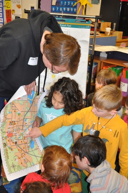
- Discuss the iterative process involved in creating a child-friendly map and how groups of children and youth will give feedback for future iterations (ie. How many drafts will you go through? How many feedback sessions do you expect to facilitate? Is the designer willing to meet with children and youth to explain their role in this map-making process?)
If you haven't already done so, we suggest that you start keeping a list of conversation topics to discuss with your map designer at your next meeting. At GUB, we created a google doc so that all team members had access, and so discussion topics could be added to the agenda at any given time.  Things to Consider When Making a CFC Map: Things to Consider When Making a CFC Map:
There are many things that you and your map designers will have to take into consideration when creating the map, but here are a few of the things you will want to ask before you begin: - What are the boundaries of the map? How much of your city will you show?
- What is your downtown area like and where is it located?
- What makes your city unique that should be included (ie. Boulder is distinct for "open space" with nature trails and the geographic landmark of The Flatirons).
- Is the map bilingual?
- Are there call-outs that highlight hot spots unique to your area? ie. We highlighted our "downtown" streets.
- What are the actual child-friendly parts of the map (parks, playgrounds, museums, etc.)?
- What are kids and youth saying about their priorities (What's important to them)?
- What would children, youth, and parents look for, or what information would they want to know?
- What should visitors to the city see–what would they want to know about?
- How can a pre-reading child be able to "read" this map?
- Do you want an amenities chart that lists services and costs for each location on the map?
- Create a style and/or branding guide as a road map to follow during the map-making process.
- Decide how you will include different sponsor’s logos? You can use GUB’s map as a reference.
A Note on Virtual and Printed Maps:Printed Maps: Printing offers limitations and will make you choose and prioritize different elements. Because of the limited space on printed maps, you will need to consider how you are creating the map based on your city's values. For example, you may ask questions such as: - Will you include for-fee locations such as stores and restaurants?
- Will you show all of the schools in a city (even if they fall outside of the map boundaries)?
- What will become a call out?
- Will it be bilingual?
- Will you include an amenities chart?
Digital Maps: Spillover can go into the digital map which has more space and flexibility. Where the printed map is limited by size, digital maps are not. You can include different elements such as family-friendly walking and biking routes, geocaching activities, fee-based activities; kids’ favorite ice cream shops, etc. You may consider including for-fee locations on the digital map as a lower tier cost option for sponsors wanting to support the project. Growing Up Boulder created their first edition map to coincide with their 10th year anniversary. Given the map's infancy, we had many fewer sponsors, and this allowed us to have extra kids' drawings, interactivity, and writing. Each year as recognition and popularity for our maps grew, so did the number of sponsorships. While we loved including the more personalized aspects in the first edition, space was just too limiting to continue including them. The decision process was MUCH easier given that we had digital maps, with more space and flexibility. Helpful Tips for Your Map Designer From Ours (the Technical Stuff!): - Secure base layer map from city and county Open Data resources
- Use GIS (Arcmap) to create the foundation of your map
- Begin elaborating on the base layer to include artistic elements, for example GUB's map included kid drawn icons
- Locate shape files: streets, pedestrian and bike paths, water elements, open space, emergency locations (hospitals, fire, and police stations), sports fields, schools, geographic landmarks specific to your city, etc.
Have fun! | 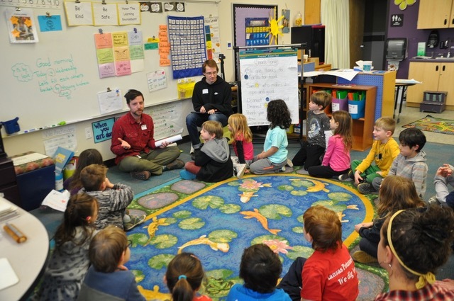
|